Posts Tagged ‘Downtown’

h1

The Telephone Company

December 14, 2014

The telephone is possibly the most rapidly advancing technology of our time.  Flip phones alone could have killed the landline, and smartphones compete with almost every other device in our lives.  Public Payphones, once ubiquitous and imperative, are now an endangered species (I’ve been documenting the survivors on my Flickr stream).

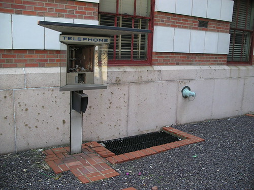
Payphone outside of the abandoned Bell Telephone Company at Locust and Beaumont

As fast as the technology changes, one physical reminder of the old days remains in many communities: The telephone company’s local exchange/switching office.

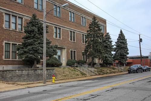
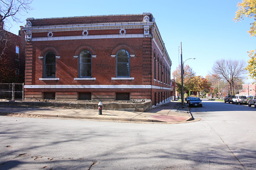
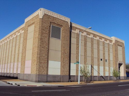
Bell Telephone Company on Natural Bridge at the St. Louis City Limits

These are in addition to the more high-profile downtown headquarters that are a part of every major American City’s skyline.

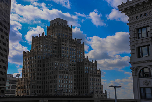
Old Bell Telephone Building in Downtown St. Louis

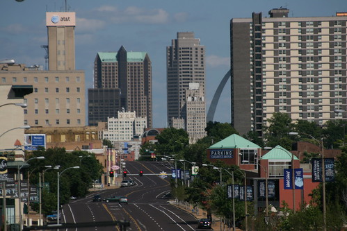
AT&T on the Skyline in St. Louis

Below are some of my favorite neighborhood/community telephone company offices in St. Louis.  My full collection of these photos are in this album on Flickr.

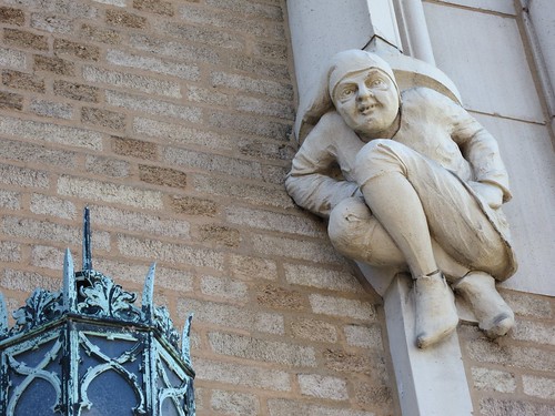
Detail on the Natural Bridge Building

Telephone Company in Kirkwood

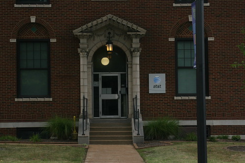
AT&T

Detail on the Building at Washington and Spring in Grand Center

Kinloch Telephone Exchange in McKinley Heights

Webster Groves AT&T Building

Downtown East Boogie

East St. Louis Telephone Company

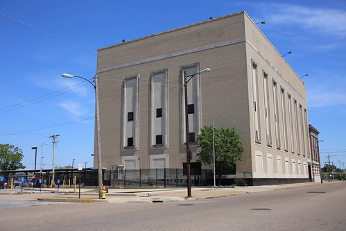
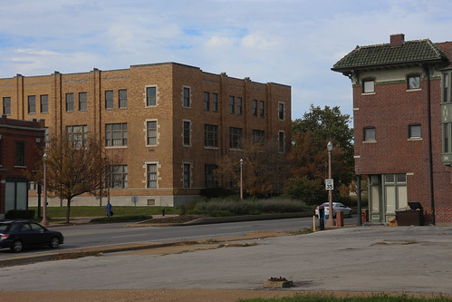
Switching Office on Delmar in the Academy Neighborhood

AT&T Building on South Grand

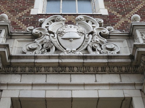
Detail on the Bell Telephone Company in Maplewood

I have yet to visit a number of other telephone company offices in the region, but hope to stumble upon more.  Happy exploring!

h1

129 Year Old Home Demolished – Gas Station Rumored Replacement

July 29, 2014

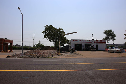
A few weeks ago I noticed a heartbreaking demolition just north of Downtown.  On one of the most active blocks in the vital transition between the heart of Downtown/Washington Avenue Loft District and neighborhoods to the north (part of Paul McKee’s Northside Regeneration), a rare reminder of contiguous urban form connecting these areas has been erased.  Built in 1885, the home pictured below was purchased for $135,000.00 just over a year ago, only to be demolished a couple of months ago at a cost of $6,000.00.

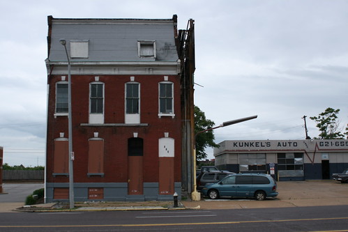
Home on N. 13th before demolition

1414 N. 13th Street – June 2013

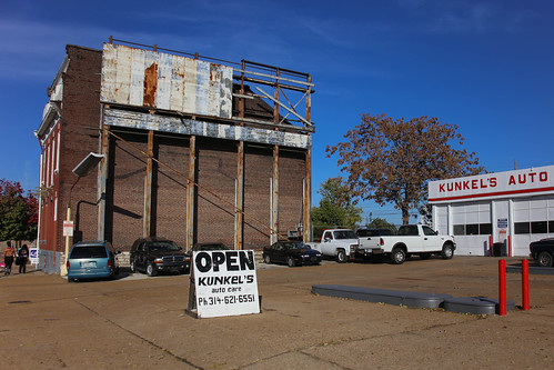
This last weekend I found the time to photograph the lot, and speak with the neighbors at Kunkel’s Auto.  Apparently the little shop’s days are numbered as well.

Soon to be demolished

Kunkel’s Auto – November 2013

The rumor is that a gas station will be going into this prime lot near the new Stan Span/Downtown interchange, and is part of Northside Regeneration’s plans for the area.

Tucker/N. 13th between Downtown and Stan Span Access

Tucker/N. 13th between Downtown and Stan Span Access

In the image above, the red circle identifies the demolished home, blue circles point out existing gas stations, and the green circle is the only other surviving home on this important stretch.  Note that much of the Tucker frontage is devoted to surface parking and inappropriate infill like the straight-out-of-suburbia McDonald’s at 1119 N. Tucker.  Single use modern housing developments barricaded from walkable downtown by superblocks and fences dominate areas to the east and west, leaving Tucker as the only feasible way that McKee’s plan can connect livable urban places to the north and south.

1414 N. 13th – Gone

By squandering what little is left of this area’s built environment for another gas station/convenience store, Northside Regeneration is proving that it’s unfit for the job of remaking this part of our city, choosing instead to double-down on the failed strategies of the last few decades.  I hope that the rumors are wrong, but can’t help but believe them.

h1

Food Truck Row and Street Vendors in St. Louis

February 22, 2013

Over the past couple of years an impressive roster of food trucks has sprung up in St. Louis despite an almost complete ban on street vendors that spans the entire region.  Street Vendors are prohibited as the default, and vending districts don’t always match up with good vending locations.  As can be seen here in St. Louis City Ordinance 65061, vending is allowed only Downtown (East of Tucker), along the river from Chouteau to Biddle, along Grand from Natural Bridge to 70, on a tiny block bounded by Broadway, Meramec and Ohio (“Licensed vendors in this district may sell agricultural products and flowers only”), and in any ward whose number ends in ‘4.’  These rules seem arbitrary and disconnected from reality.

From St. Louis City Ordinance 65061

SECTION THREE. Vending prohibited; exceptions.

No person shall sell or offer for sale or permit the offering or selling of any goods, wares, merchandise, flowers, horticultural products, services, food or beverages upon any public sidewalk, street, roadway, or roadway median within the City of St. Louis except in those areas designated by ordinance as Vending Districts.

Although these laws are often unenforced, they’re on the books.  Luckily not every entrepreneur has been deterred.  Stands selling BBQ or hot dogs, t-shirts and rugs, bootleg CDs/DVDs and  sno-cones can be seen on vacant lots or in front of businesses all over the city.  While I’m sure that some of these businesses are licensed, some are certainly not.

BBQ Truck/Trailer Jamaican in North St. Louis, Missouri

Mi Hungry Bar-B-Que on North Kingshighway – I remember eating here 6 or 7 years ago off Grand.  Pretty tasty stuff.

Recently, food trucks have been bringing street vendors the kind of positive attention that could lead City Hall(s) to rethink their restrictive ordinances.  While food trucks are not new to St. Louis, the 20-30 that have popped up over the last couple of years represent something new.  These businesses feature creative options that differentiate them from the conventional American hot dog stand or taco truck.  Over the past two years I’ve visited food trucks with specialties ranging from Korean Tacos to grilled cheese sandwiches, Filipino rice bowls to po-boys, Vietnamese sandwiches to gyros and from sushi rolls to crepes.  The diversity of options that have appeared in this relatively short time span is incredible.

Comfort Food/Soul Food on Chestnut in front of Anthem in Downtown West

Street Life Food Truck – Recently featured in a great music video: https://www.youtube.com/watch?v=Aiy6-Wp_7WA

As these new eateries have proliferated, they have established a growing list of lunchtime parking spots to rotate between.  Popular locations include CityGarden, Wells Fargo Advisors (Beaumont and Pine), SLU Pius Library, Anthem (19th and Chestnut), Washington University Medical Center (Taylor and Scott), and Purina on Chouteau.  With the exception of CityGarden, most of these places don’t usually attract pedestrians.  They are all in close proximity to large daytime populations, but sit on the edge of parking lots, or underused green space.  One contributing factor is that St. Louis Food Trucks are Pretty Much Banned from Parking Anywhere Ever.

Food Trucks at St. Louis University - Popular Lunch Destination

Food Trucks outside of SLU’s Pius Library on Lindell

In a positive step towards accepting these mobile vendors, City Hall established “Food Truck Row” on 13th Street between Market and Chestnut this last summer.  Granted, this spot is located on the Gateway Mall in the Civic Center (often referred to by suburbanites as “Homeless Park”), and is more convenient to City Hall employees than anyone else, but it’s a nice gesture.  As someone who works in Downtown West (but not at one of the huge organizations that can attract their own food trucks), I find Food Truck Row to be one of my more conveniently located lunch options (behind Mom’s Kitchen, Hoagie City, The White Knight Diner and Imo’s on Washington).

Zia's on the Hill has an incredible Food Truck

Zia’s at Food Truck Row

Although it has been reported that business at Food Truck Row is slow, I’ve seen some busy lunch hours there.  It can also be anticipated that business will improve once SLU’s Law School is completed, and the renovation of the Municipal Courts Building should also help out.  One thing that the City could do to help, is add more seating!  There are currently only three tables in this rather large park, and none in the adjacent blocks of green space.

Fireman's Memorial in the Gateway Mall is home to Food Truck Row

Food Truck Row needs more Tables

Keep an eye out for Food Trucks around town, and try to support the ones that stop at Food Truck Row.  There are some really incredible chefs behind many of these trucks, and just as the food truck gives them the opportunity to try out their business, it gives us an opportunity to try out their food.

For daily map of Food Truck Parking spots, check out http://showmefoodtrucks.com/.

h1

Chesterfield Commons and Downtown St. Louis

January 17, 2013

Chesterfield Commons is a gigantic strip mall that runs along highway 40. If you’ve never been (don’t go), it’s like every single big box store you’ve ever seen strung together in a giant row. From the Chesterfield Chamber of Commerce’s website:

A great place for one-stop shopping. Seven large retailers – Sam’s Club, Wal-Mart Super Center, Target, Best Buy, Dick’s Sporting Goods, Home Depot, and Lowe’s Home Improvement Warehouse – presently anchor this 1.9 million square foot commercial development. When finished it will be over 2 million square feet and 1.5 miles long, making it the largest open-air retail center in the country. Chesterfield Commons currently hosts more than 100 shops and 30 restaurants in this beautifully maintained location. The Galaxy cinema features a 500-seat auditorium with the region’s largest movie screen – measuring more than 5 stories. – Chesterfield, MO Chamber of Commerce

I like that it’s described as an “open-air retail center.” It’s a 1.5 mile strip of big box stores fronted by parking lots. Click the photo below to see the area in Google maps.

1.5 miles is huge. That’s the distance from 4th street to Jefferson.

“In business, it’s all about location. Chesterfield has easy access, a good road system and good demographics,” said Robey Taylor, executive director of the Chesterfield Chamber of Commerce. – St. Louis Business Journal

Downtown St. Louis (the combined Downtown and Downtown West Neighborhoods), is about 1.5 miles long. A single building, the Railway Exchange, has more than half the interior square footage of THF’s Chesterfield Commons.

However abundant land may seem, it is a finite resource, and its misuse contributes to many types of waste beyond that of square-footage (or acres or square miles). We currently have plenty of vacant land within the boundaries of St. Louis City, as well as available office, residential and retail space in every class. St. Louis needs to wake up to the fact that exclusively auto-centric greenfield development is a poorly considered and shortsighted investment. Maybe after those new outlet malls are completed we’ll have had enough.

Parking Lot that goes on and on for miles

Chesterfield Commons – Summer 2010

Suburban Sprawl Flood Plains St. Louis, MO

Aerial taken 7/11/2013 – Huge Outlet Mall across 64/40 is dwarfed by Chesterfield Commons


h1

Seattle’s Pedestrian Master Plan

July 1, 2011

I’ve spent the last week or so in Seattle, and have been extremely impressed with the city.  Seattle’s Central City is a continuous, walkable urban environment, that is unlike the vast majority of American cities I’ve been to.  In Seattle, the “inner-city” is a truly desirable place to be (as it should be).  Although it is not completly free of empty storefronts and surface parking lots, when compared to a place like St. Louis these underused spaces are a non-issue.

Seattle has its problems too

I am aware that Seattle and St. Louis have more differences than similarities, but I disagree with those who say we have nothing to learn from a city so dissimilar.  Seattle’s Metropolitan Area is not significantly larger than St. Louis’ (only having recently surpassed us), but it has the resources to experiment.  We need to be paying attention to even our more distant peers if we want to stay competitive.

Section of Chinatown cut off from Downtown by Interstate 5

Seattle has made many of the same mistakes that St. Louis has.  They have an interstate highway running through their downtown.  They have two major sports stadiums that take up superblocks and are surrounded by underused parking garages in a historic district.  At the same time, they value good urban design and the pedestrian experience.  For me, Seattle has many new ideas to offer.  Good ideas.  One big one that struck me is the Downtown Transit Tunnel.

The Downtown Seattle Transit Tunnel

Seattle’s Light Rail runs through Downtown in a tunnel, but the tracks run on a paved, flat surface that is also used by buses.  This is brilliant for many reasons (it keeps you out of both traffic and the rain), and is a flexible infrastructure investment.  My one complaint is that you aren’t allowed to simply walk across the tracks to the other platform to change directions.

Illegal to Cross

As convenient as being able to walk across the tracks would be for an urban explorer and photographer like myself, walking up and over is a small sacrifice for us to make on behalf of public safety.  The City of Seattle actually cares about pedestrians and their safety, and it shows.  Little details can make big differences.  This year Seattle was recognized as the most “walk-friendly” city in the country by the NRDC, and in the City’s Pedestrian Master Plan, Seattle declares that it wants to truly become the most walkable city in the nation.

Alternatives to the Car

Featuring before and after photos of transformed sidewalks that would be sure to make Steve Patterson proud, the Pedestrian Master Plan’s website lays out a detailed plan with ambitious goals that focus on the pedestrian experience.  It outlines the benefits of walking and the responsibility of the city to encourage and to facilitate alternatives to personal automobiles.

Seattle has a Large Network of Trolley Buses

I think that the City of St. Louis can learn from cities like Seattle.  Our problems are not unique to the rust belt, and their solutions might found if the time was spent creating something like a master plan.  We have a long way to go before we can even compete in a walkable city competition, but we need to start with a coherent (unlike many of my blog posts – Sorry!) and comprehensive plan.  Let’s start Downtown and connect our neighborhoods to one another.  Otherwise newer, faster growing cites like Seattle will leave us in the dust.  Or in the fumes of our own exhaust.

h1

The 10th Street Mall in LaSalle Park

June 21, 2011

A few weeks ago I had the day off and needed to take my car to the shop, so for the first time in a while I was able to do some St. Louis Exploring.  For lack of a better idea, I simply took the bus downtown and starting walking toward Soulard, knowing that I didn’t really have a good grasp of what lay in between.  The dead zones between our “destination neighborhoods” are one of the biggest problems St. Louis has to tackle.

LaSalle Park

Crossing under Highway 40 on Broadway I entered LaSalle Park, a hidden gem nestled between Soulard, Layfayette Square and Downtown.  The neighborhood is cut off from the rest of the city by highways, and the damaged street grid leaves its few surviving blocks particularly isolated.   A Pedestrian Mall replaces Tenth Street from Hickory to Park Avenue, effectively separating the renovated historic homes to the east, from the mess of urban renewal to the west.

Tenth Street Mall in LaSalle Park

Dead-end streets north of Park on Ninth Street have been turned into cul-de-sacs, but they are shady, quiet, relatively dense, and feel great to walk down.  Large bushes visually separate the cul-de-sacs from the pedestrian mall, but the sidewalks merge into it.  The mall itself is both devoid of life and overgrown.

10th Street Pedestrian Mall from Park

In many ways, the Tenth Street Mall reflects St. Louis urban planning in general.  It has preservation on one side and auto-centric modern development  on the other.  It has glaring successes and failures.  It is cool and attractive but also lacks maintenance and use.  For many, however, it seems that LaSalle Park has the best of both worlds.  It is in the middle the city, but feels suburban in many ways.  It’s both old and new.  It has a totally random pedestrian mall running through part of it; and apparently that’s what people like because LaSalle Park is one of a small handful of St. Louis City neighborhoods to have gained population in 2010.  If you haven’t been, go check it out – the experience is quite pleasant.

More photos of LaSalle Park can be found here.

h1

Cass Avenue Bridge Construction Progress

March 20, 2011

Today I drove up North Broadway from downtown and observed the progress that has been made on the new Cass Avenue Bridge (that’s what I’m calling it). This is an exciting new project which opens up the possibility to reverse the terrible decision we made, sending highway 70 right through Downtown St. Louis and cutting it off from the Arch/Riverfront. CitytoRiver is still working to turn this great opportunity into reality.

Cass Avenue Bridge Construction

The Contractors, it seems, are also working quickly to make this bridge a reality.  A good portion of the land approach has been built (presumably on both sides of the river), and the large number of cranes on both sides makes me think that it won’t be too long until they start to cross the Mississippi.

Cass Avenue Bridge Construction

After my visit today I look forward to the view of Downtown St. Louis that will be enjoyed from the bridge once it has been completed.  By climbing up on a big pile of dirt and concrete I was able to to get a sneak peak.

Downtown from the Cass Avenue Bridge

I even think it was worth the risks I took with my Wallabees.

For more photos of the Cass Avenue Bridge see my Flickr set here.

h1

Light Rail in Denver and Salt Lake City

September 5, 2010

I recently spent some time in both Denver and Salt Lake City, both places that have many examples of urban planning successes and failures that serve as great learning experiences.  Denver’s 16th Street Mall and Salt Lake’s “The Gateway” and City Creek Center developments represent large downtown projects worthy of serious study.  One thing that all three of these developments have in common is the fact that they are served by light rail that runs on city streets.  Both light rail systems are also very similar to ours in St. Louis (we use Siemens SD-400 and SD-460, while Denver and Salt Lake both use the SD-100 and SD-160).  The main difference between St. Louis’ Metrolink and TheRide in Denver/UTA Trax in Salt Lake City is the height of the platforms and the lack of a dedicated right of way (at least in the center city).  Because the platforms are basically just the sidewalks in Denver or sidewalk-like medians in Salt Lake, entering the train requires walking up steps (like getting onto the bus).  To accommodate people with disabilities or parents with strollers, etc.,  both systems have ramps leading up to elevated platforms at the front of each train.

18th and California Station - Denver, Colorado

The elevated section of the platform can be seen towards the back of the above photo.  Below is a picture of a UTA Trax Train approaching a platform, with the accessible section towards the lower right of the photo.

UTA Trax Train in Downtown Salt Lake City

A view from the platform itself provides a better idea of how this raised section really works.

UTA Trax Accessible Train Entry

Seeing this system firsthand was a really good experience for me, because it served as confirmation that a new  Metrolink lines could run right down the middle (or edges) of our excessively wide avenues in St. Louis.  In particular, the new North-South line could run through downtown on Tucker (12th Street) and extend South along Gravois (which Tucker turns into) and North along N. Florissant (which Tucker also turns into).  On the North side, the line could make a Westward turn onto Natural Bridge from N. Florissant to provide a more central route.  Because Tucker is currently being torn up and replaced just North of Downtown, this would be a great place (and time) to begin the project.  The route could connect to the existing Metrolink line with a Viaduct stop similar to the Grand Station, or riders could simply walk the two blocks to 14th street or the 4 blocks to 8th street to change lines.  Maybe it could be the Green Line!

Possible Future Metrolink Map?

I know this idea is not by any means new, and a similar route is what most of us have been hoping we’ll get in the near future (particularly since the passage of Prop A), but I really think that this line on existing city streets would be most affordable, and would have the potential to do the most good.  Extending Metrolink along Highway 55 is silly to me, because the areas around the highway are not pedestrian friendly.  Gravois could really use some pedestrian activity to activate businesses that already exist and create a demand for more businesses along this street which essentially serves as a high speed thruway.   The addition of light rail to this corridor will also reduce the auto traffic.

On the North side this line would serve as a much needed catalyst to spur development along the largely abandoned shoulders of N. Florissant (many of which are clean slates for new construction) and would also connect the steadily improving Old North St. Louis neighborhood with Downtown.  Although Buses will remain the centerpiece of our regional transportation system, expanding our light rail increases the visibility of transit, the likelihood that it will be used, and that the neighborhoods it serves will be explored.

h1

Costco Plans Urban Superstore Downtown

May 18, 2010

As much as I hate Wal-Mart and refuse to shop there, seeing an Urban Wal-Mart in White Plains, NY made me think that Downtown St. Louis could actually capitalize off of Wal-Mart’s extreme popularity in our region if a similarly urban store was built on one of our numerous vacant lots downtown.

Urban Wal-Mart in White Plains, NY

As unlikely as this seems, particularly without tax-incentives (which I really hate to see Wal-Mart receive), maybe we can make it happen by spreading rumors that Costco has a similar idea.  Who knows?  Maybe Wal-Mart could be an asset to our city for a change!

h1

Tucker Tunnel Update

March 22, 2010

I’m sure everyone has been kicked out of the Tucker Tunnel for a while now, but just today I went down to check it out.  Tucker was being worked on above and below ground in several places making it now much more clearly an unsafe living place.

Workers underneath Tucker

Above ground Interco plaza wasn’t looking too different, but there is currently a port-a-potty in the park notifying its reader that the city will no longer put people’s belongings into a trash compactor.  I’d call this a good sign.

Public Notice in Interco Plaza

Anyway, as much as I have been facinated by the mere existance of the Tucker Tunnel, this part of Downtown is in such terrible shape that I can’t wait to see what the area looks like after getting a fresh start from the street rebuilding project.

I’m actually pretty excited to tell the story of the Tucker Tunnel while driving up the fresh new Boulevard in the near future.

Update:  People are still living in the tunnel as of 5/12/2010. The Post-Dispatch says that Mayor Slay wants the tunnel vacated by Friday May 14th.